Dingle Peninsula and Slea Head Day Tour
Killarney, Ireland
Trip Type: Day Trips
Duration: 7 hours
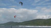
Dingle Day Tour The Dingle Peninsula which stretches out into the Atlantic ocean, is the most northerly of the mountainous promontories which forms the indented coast of South-west Ireland. It is particularly notable in its scenery of the mountain and coast and is of interest on account of its antiquities
More About This Activity All Day Trips →
Dingle Day Tour The Dingle Peninsula which stretches out into the Atlantic ocean, is the most northerly of the mountainous promontories which forms the indented coast of South-west Ireland. It is particularly notable in its scenery of the mountain and coast and is of interest on account of its antiquitiesFrom Slea Head one can see the Blasket Islands which are the last outposts of Europe and are known as the “next parish to America”. They are famous for the literary and linguistic heritage of the former inhabitants. However, these remote islands have been uninhabited since the 1950’s following an evacuation. This Western end of the peninsula is a Gaeltacht area that has produced a number of nationally notable authors and poets: O’Siochfhradha and Peig Sayers among others. Being an Irish speaking district traditional customs are still very much alive.
The Peninsula exists because of the band of sandstone rock that forms the Slieve Mish mountain range at the neck of the peninsula in the east, and the unnamed central mountain range further to the west. Ireland’s highest mountain outside the Macgillycuddy’s Reeks, Mount Brandon at 951m, forms part of a beautiful high ridge with stunning views over the peninsula and North Kerry.
The Dingle peninsula is named after the town of Dingle. The peninsula is also commonly called Corca Dhuibhne even when those referring to it are speaking in English. Which means “seed or tribe of Duibhne” (an Irish personal name), takes its name from the tuath (people, nation) of Corco Dhuibhne who occupied the peninsula in the Middle Ages and who also held a number of territories in the south and east of county Kerry. Dingle was the chief port of Kerry in the old Spanish trading days and in the reign of Queen Elizabeth was important enough to be a walled town.
The peninsula is the location of numerous prehistoric and early medieval remains – for example, the Gallarus Oratory in the very west of the peninsula near the village of Baile an Fheirtearaigh in Ard na Caithe.
Again this is an ideal opportunity for your to forget about the left hand side of the road and let our knowledgeable and friendly guides take care of you for the day. The tour returns to Killarney in the evening approx 17.00h.
« Go Back

